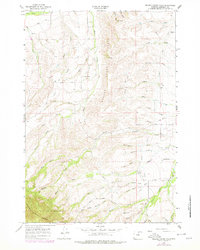
1964 Map of Beaver Creek Hills
USGS Topo · Published 1978About this map
Beaver Creek Hills dominate this Sheridan County landscape, where the rugged eastern foothills transition into the high elevations of the Bighorn National Forest. The map documents a complex network of ranching and water management infrastructure, characterized by numerous named draws such as Peralta Draw, Nelson Draw, and Wymer Draw. These drainages feed into the larger basins of Big Goose Creek and Beaver Creek. A notable man-made addition to the landscape is the Polo Field and Landing Strip located near the confluence of Colorado Creek and Hanna Creek. The presence of the Red Grade road and landmarks like Government Gap and Curlew Hill illustrate the historical routes used to navigate this varying terrain. Water rights and irrigation are highlighted by the various ditches and pipelines that weave through the draws, supporting the agricultural life of the valley below the mountain front.
Find a feature on this map
47 named features on this map. Tap any name to fly to it.
Don’t see what you’re looking for? This feature index may not catch every label — zoom into the map to look around manually.
Map Details
Editions of this 1964 Beaver Creek Hills Map
3 editions found
Other maps of this area

1895 · Dayton
USGS Topo · 1:125,000

1901 · Dayton
USGS Topo · 1:125,000

1909 · Sheridan
USGS Topo · 1:125,000

1911 · Sheridan
USGS Topo · 1:125,000

1955 · Sheridan
USGS Topo · 1:250,000

1958 · Sheridan
USGS Topo · 1:250,000

1962 · Sheridan
USGS Topo · 1:250,000

1964 · Wolf
USGS Topo · 1:24,000

1964 · Beckton
USGS Topo · 1:24,000
1964 · Hultz Draw
USGS Topo · 1:24,000