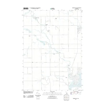
2011 Map of Sherman City
USGS Topo · Published 2011About this map
The Chippewa River anchors this landscape, winding through a region where agriculture and energy production coexist. The map details the scattered rural settlements of Sherman City, Horr, Titus, and Drew, each connected by a grid of numbered roads and county lines. Industry is represented by the Coldwater Oil and Gas Field in the north and the Sherman Oil Field further south, indicating the region's reliance on natural resources.
Find a feature on this map
76 named features on this map. Tap any name to fly to it.
Don’t see what you’re looking for? This feature index may not catch every label — zoom into the map to look around manually.
Map Details
Editions of this 2011 Sherman City Map
This is the sole edition of this map. No revisions or reprints were ever made.
Other maps of this area

1916 · Mount Pleasant
USGS Topo · 1:62,500

1919 · Mount Pleasant
USGS Topo · 1:62,500

1943 · Mount Pleasant
USGS Topo · 1:62,500

1954 · Midland
USGS Topo · 1:250,000

1958 · Midland
USGS Topo · 1:250,000

1959 · Midland
USGS Topo · 1:250,000

1959 · Lake
USGS Topo · 1:62,500

1959 · Clare
USGS Topo · 1:62,500

1964 · Mecosta NW
USGS Topo · 1:24,000

1964 · Blanchard
USGS Topo · 1:24,000