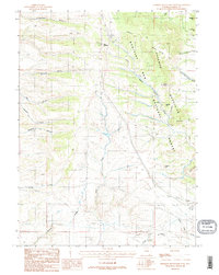
1987 Map of Sherman Mountains West
USGS Topo · Published 1987About this map
The Sherman Mountains define this high-altitude landscape within the Medicine Bow National Forest during the late 1980s. A notable cultural landmark, the pyramidal Ames Monument, stands near the southern edge of the sheet, marking the highest point on the original transcontinental railroad route. The terrain is deeply incised by a network of drainages including Dale Creek and Lone Tree Creek, while prominent granite formations like Turtle Rock and Brady Rock punctuate the mountain slopes.
Find a feature on this map
38 named features on this map. Tap any name to fly to it.
Don’t see what you’re looking for? This feature index may not catch every label — zoom into the map to look around manually.
Map Details
Editions of this 1987 Sherman Mountains West Map
2 editions found
Other maps of this area

1895 · Laramie
USGS Topo · 1:125,000

1902 · Laramie
USGS Topo · 1:125,000

1905 · Sherman
USGS Topo · 1:125,000

1905 · Laramie
USGS Topo · 1:125,000

1906 · Laramie
USGS Topo · 1:125,000

1908 · Laramie
USGS Topo · 1:125,000

1948 · Sherman Mountains
USGS Topo · 1:62,500

1948 · Ragged Top Mountain
USGS Topo · 1:62,500

1950 · Ragged Top Mountain
USGS Topo · 1:62,500

1950 · Sherman Mountains
USGS Topo · 1:62,500