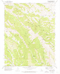
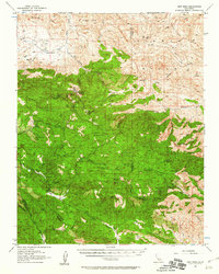
1969 Map of Sherman Peak
USGS Topo · Published 1973About this map
Coalinga Mineral Springs stands as a focal point in this remote section of the Diablo Range during the late 1960s. The landscape is defined by the high, weather-beaten terrain of Juniper Ridge and Bald Mountain, which separate numerous seasonal drainages like Grabast Canyon and Hot Springs Canyon. To the north, the Los Gatos Creek County Park and a small Cem suggest early community activity centered around the permanent water of Los Gatos Creek.
Find a feature on this map
53 named features on this map. Tap any name to fly to it.
Don’t see what you’re looking for? This feature index may not catch every label — zoom into the map to look around manually.
Map Details
Editions of this 1969 Sherman Peak Map
3 editions found
Other maps of this area

1912 · Coalinga
USGS Topo · 1:125,000

1915 · Priest Valley
USGS Topo · 1:125,000

1941 · Priest Valley
USGS Topo · 1:62,500

1943 · New Idria
USGS Topo · 1:62,500

1943 · Joaquin Rocks
USGS Topo · 1:62,500
1944 · Coalinga
USGS Topo · 1:62,500

1944 · Priest Valley
USGS Topo · 1:62,500

1948 · Santa Cruz
USGS Topo · 1:250,000

1955 · Santa Cruz
USGS Topo · 1:250,000
1956 · New Idria
USGS Topo · 1:62,500