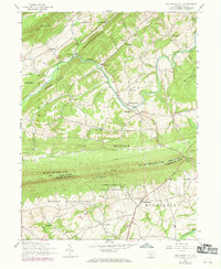
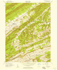
1952 Map of Shermans Dale
USGS Topo · Published 1969About this map
Sherman Creek meanders through the heart of this landscape, carving a valley between the parallel ridges of Rattlesnake Ridge and Pisgah Ridge. This rural stretch of Perry County is defined by a network of small schoolhouses and churches that served the agricultural valley, including the Sandy Hollow School and Mt Gilead Church. The central settlement of Shermans Dale sits as a local hub near the winding creek, while the southern portion of the sheet transitions into Cumberland County across the formidable barrier of Blue Mountain.
Find a feature on this map
53 named features on this map. Tap any name to fly to it.
Don’t see what you’re looking for? This feature index may not catch every label — zoom into the map to look around manually.
Map Details
Editions of this 1952 Shermans Dale Map
4 editions found
Other maps of this area

1904 · Carlisle
USGS Topo · 1:62,500

1907 · New Bloomfield
USGS Topo · 1:62,500

1919 · Newville
USGS Topo · 1:62,500

1930 · Loysville
USGS Topo · 1:62,500

1933 · Loysville
USGS Topo · 1:62,500

1943 · New Bloomfield
USGS Topo · 1:62,500

1943 · Carlisle
USGS Topo · 1:62,500

1945 · Newville
USGS Topo · 1:62,500

1950 · Harrisburg
USGS Topo · 1:250,000
1952 · Ickesburg
USGS Topo · 1:24,000
Featured Places
- Middlesex Township, PA
- Schlusser, PA
- Dromgold, Carroll Township
- Wheatfield Township, PA
- Crums Corners, Carroll Township