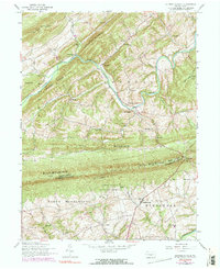
1952 Map of Shermans Dale
USGS Topo · Published 1990About this map
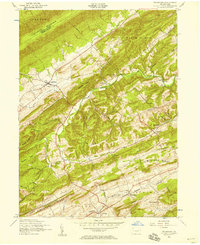
Sherman Creek meanders through a landscape defined by prominent ridges and rural crossroads in the early 1950s. The settlement of Shermans Dale serves as a central hub, surrounded by a dense network of country institutions such as Any View School and Wolf Church. To the south, the terrain rises sharply toward Blue Mountain, where the U S Military Reservation Carlisle Barracks Mountain Area occupies the wooded slopes above Carlisle Springs. The map documents early industrial remnants like the Perry Furnace near Falling Spring, illustrating how the Cumberland and Perry County borderlands transitioned from a furnace-and-mill economy toward a mid-century residential and agricultural pattern. The presence of several family-named schools and churches, including Barn Hills School and Waggoner Church, provides specific touchpoints for local genealogical research.
Find a feature on this map
50 named features on this map. Tap any name to fly to it.
Don’t see what you’re looking for? This feature index may not catch every label — zoom into the map to look around manually.
Map Details
Editions of this 1952 Shermans Dale Map
4 editions found
Other maps of this area

1904 · Carlisle
USGS Topo · 1:62,500

1907 · New Bloomfield
USGS Topo · 1:62,500

1919 · Newville
USGS Topo · 1:62,500

1930 · Loysville
USGS Topo · 1:62,500

1933 · Loysville
USGS Topo · 1:62,500

1943 · New Bloomfield
USGS Topo · 1:62,500

1943 · Carlisle
USGS Topo · 1:62,500

1945 · Newville
USGS Topo · 1:62,500

1950 · Harrisburg
USGS Topo · 1:250,000
1952 · Ickesburg
USGS Topo · 1:24,000
Featured Places
- Middlesex Township, PA
- Schlusser, PA
- Dromgold, Carroll Township
- Wheatfield Township, PA
- Crums Corners, Carroll Township