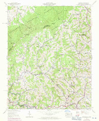
1938 Map of Sherwood
USGS Topo · Published 1971About this map
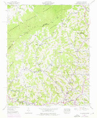
Sherwood and the winding valley of Cove Creek serve as the focal point for this 1938 survey of the North Carolina and Tennessee borderlands. The landscape is defined by the intersection of the Cherokee National Forest and Pisgah National Forest, where steep ridgelines like Cove Ridge and Tree Ridge separate isolated communities. A high density of rural institutions, including the Beaverdam School and Sugar Grove School, alongside the Beaverdam Cemetery and Henson Chapel Cemetery, indicates a well-established social fabric in these mountain hollows. The hydrology is dominated by the Watauga River in the south and Roan Creek in the north, with several named gaps such as Vaught Gap and Locust Gap providing the only passage through the high terrain. Agricultural activity is clearly marked by field lines along the valley floors near settlements like Amantha and Mabel.
Find a feature on this map
74 named features on this map. Tap any name to fly to it.
Don’t see what you’re looking for? This feature index may not catch every label — zoom into the map to look around manually.
Map Details
Editions of this 1938 Sherwood Map
5 editions found
Other maps of this area

1893 · Cranberry
USGS Topo · 1:125,000

1895 · Cranberry
USGS Topo · 1:125,000

1899 · Cranberry
USGS Topo · 1:125,000

1902 · Cranberry
USGS Topo · 1:125,000

1934 · Valle Crucis
USGS Topo · 1:24,000

1934 · Elk Park
USGS Topo · 1:24,000

1934 · Boone
USGS Topo · 1:24,000
1935 · Doe
USGS Topo · 1:24,000

1935 · Baldwin Gap
USGS Topo · 1:24,000

1935 · Doe Mountain
USGS Topo · 1:48,000