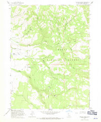
1963 Map of Shields Creek
USGS Topo · Published 1971About this map
Modoc National Forest dominates this mid-century landscape, where a network of water sources and narrow canyons defines the northern California interior. Water management is central to the area's utility, marked by the presence of Porter Reservoir and numerous natural outlets such as Fitzhugh Springs, Fern Spring, and Pine Spring Springs. The drainage system is complex, with the North Fork, South Fork, and Middle Fork of various creeks carving through the terrain near Dry Creek Basin.
Find a feature on this map
30 named features on this map. Tap any name to fly to it.
Don’t see what you’re looking for? This feature index may not catch every label — zoom into the map to look around manually.
Map Details
Editions of this 1963 Shields Creek Map
4 editions found
Other maps of this area

1886 · Alturas
USGS Topo · 1:250,000

1892 · Alturas
USGS Topo · 1:250,000

1954 · Alturas
USGS Topo · 1:250,000

1958 · Alturas
USGS Topo · 1:250,000

1962 · Alturas
USGS Topo · 1:250,000

1962 · Davis Creek
USGS Topo · 1:62,500

1962 · Cedarville
USGS Topo · 1:62,500

1963 · Warren Peak
USGS Topo · 1:24,000

1963 · Little Juniper Reservoir
USGS Topo · 1:24,000

1963 · Shields Creek
USGS Topo · 1:24,000