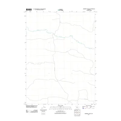
2011 Map of Shimmins Lake SE
USGS Topo · Published 2011About this map
The Dismal River carves a winding path across this portion of the Nebraska Sandhills, defining the local hydrology and landscape. In this region of Hooker County, the river's serpentine course is the primary natural landmark, while a sparse network of section roads provides access through the open terrain. Major transport arteries include Ringold Seneca Rd and Seneca S Rd, which traverse the northern and central portions of the quadrangle. To the south, Paxton Santo Rd follows the lower boundary, reflecting the area's characteristic large-scale ranching or agricultural divisions. This survey captures a specific moment in the early 21st century when these rural routes remained the essential lifelines for the remote Nebraska interior.
Find a feature on this map
4 named features on this map. Tap any name to fly to it.
Don’t see what you’re looking for? This feature index may not catch every label — zoom into the map to look around manually.
Map Details
Editions of this 2011 Shimmins Lake SE Map
This is the sole edition of this map. No revisions or reprints were ever made.
Other maps of this area

1948 · Thedford
USGS Topo · 1:62,500

1949 · Cody Lake
USGS Topo · 1:62,500

1950 · Thedford
USGS Topo · 1:62,500

1950 · Shimmins Lake
USGS Topo · 1:62,500

1951 · Tryon
USGS Topo · 1:62,500

1951 · Cody Lake
USGS Topo · 1:62,500

1954 · North Platte
USGS Topo · 1:250,000

1956 · North Platte
USGS Topo · 1:250,000

1957 · North Platte
USGS Topo · 1:250,000

1967 · North Platte
USGS Topo · 1:250,000