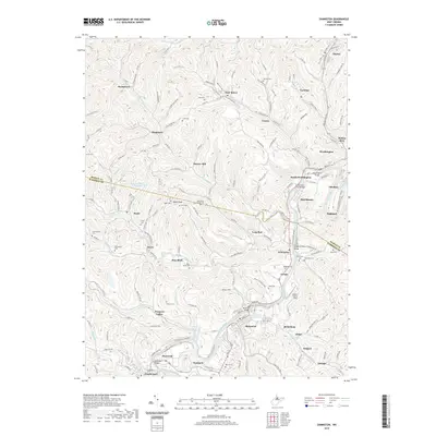
2019 Map of Shinnston
USGS Topo · Published 2019About this map
Shinnston and Lumberport anchor the southern reaches of this West Virginia landscape, where the West Fork River winds through a valley defined by coal history and river-crossings. The map reveals a dense network of company towns and mining settlements such as Four States, Idamay, and Carolina, many of which were founded to support the region's massive extraction industry. Along the river, historical infrastructure is still evident through named structures like the Hutchinson Truss Bridge and the Haywood Bridge, while the W Fork River Rail-Trail marks the path of former industrial rail lines. Genealogists will find a wealth of local history in the numerous family-named burial grounds, including Michael D Martin Cem, McIntyre Cem, and Richardson Cem, which are scattered among the steep hollows between Odell Knob and the various branches of Bingamon Creek.
Find a feature on this map
79 named features on this map. Tap any name to fly to it.
Don’t see what you’re looking for? This feature index may not catch every label — zoom into the map to look around manually.
Map Details
Editions of this 2019 Shinnston Map
This is the sole edition of this map. No revisions or reprints were ever made.
Other maps of this area

1902 · Clarksburg
USGS Topo · 1:62,500

1902 · Fairmont
USGS Topo · 1:62,500

1904 · Blacksville
USGS Topo · 1:62,500

1905 · Mannington
USGS Topo · 1:62,500

1910 · Clarksburg
USGS Topo · 1:62,500

1923 · Blacksville
USGS Topo · 1:62,500

1923 · Fairmont
USGS Topo · 1:62,500

1923 · Mannington
USGS Topo · 1:62,500

1923 · Clarksburg
USGS Topo · 1:62,500

1925 · Blacksville
USGS Topo · 1:62,500