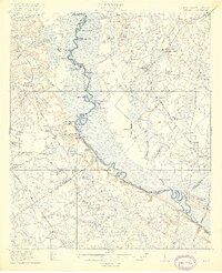
1919 Map of Shirley
USGS Topo · Published 1919About this map
The Savannah River snakes along the boundary between South Carolina and Georgia, serving as the dominant geographic feature for this 1919 survey. Along its banks, numerous landings such as Poor Robin Landing, Hudsons Ferry Landing, and Porters Landing facilitate a river-based economy, connecting the remote lowlands to broader markets. The landscape is a network of marshes and watercourses, including Boggy Swamp and Rum Gully, which were navigated via river reaches like Little Cornhouse Reach and Goldwires Reach.
Find a feature on this map
89 named features on this map. Tap any name to fly to it.
Don’t see what you’re looking for? This feature index may not catch every label — zoom into the map to look around manually.
Map Details
Editions of this 1919 Shirley Map
3 editions found
Other maps of this area

1918 · Varnville
USGS Topo · 1:62,500

1918 · Oliver
USGS Topo · 1:62,500

1919 · Pineland
USGS Topo · 1:62,500

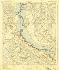
1919 · Shirley
USGS Topo · 1:62,500

1919 · Egypt
USGS Topo · 1:62,500

1920 · Hardeeville
USGS Topo · 1:62,500

1920 · Hilltonia
USGS Topo · 1:62,500

1920 · Oliver
USGS Topo · 1:62,500

1920 · Peeples
USGS Topo · 1:62,500

1921 · Brooklet
USGS Topo · 1:62,500