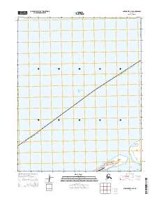
2014 Map of Shishmaref B-3 SE
USGS Topo · Published 2014About this map
Sarichef Island serves as the focal point for this coastal survey, home to the Inupiat village of Shishmaref. Located along the Chukchi Sea, the settlement is concentrated on the southern end of the island, where Main Street runs through the community near the Shishmaref Airport. The map highlights the narrow geographical position of the village, perched between the open Chukchi Sea to the north and the expansive Shishmaref Inlet to the south.
Find a feature on this map
10 named features on this map. Tap any name to fly to it.
Don’t see what you’re looking for? This feature index may not catch every label — zoom into the map to look around manually.
Map Details
Editions of this 2014 Shishmaref B-3 SE Map
This is the sole edition of this map. No revisions or reprints were ever made.
Other maps of this area

1950 · Shishmaref
USGS Topo · 1:250,000

1950 · Shishmaref A-2
USGS Topo · 1:63,360
1950 · Shishmaref B-2
USGS Topo · 1:63,360

1950 · Shishmaref A-3
USGS Topo · 1:63,360
1950 · Shishmaref B-3
USGS Topo · 1:63,360

1951 · Shishmaref
USGS Topo · 1:250,000
2014 · Shishmaref A-2 NW
USGS Topo · 1:25,000
2014 · Shishmaref A-3 NW
USGS Topo · 1:25,000
2014 · Shishmaref A-3 NE
USGS Topo · 1:25,000
2014 · Shishmaref B-2 SW
USGS Topo · 1:25,000