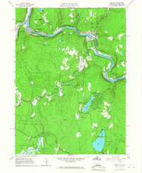
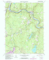
1965 Map of Shohola
USGS Topo · Published 1967About this map
The Delaware River carves a sharp, winding boundary between Pennsylvania and New York in this mid-1960s study, where the Erie Lackawanna railroad tracks mirror the river's curves through Shohola. This area is rich with historical markers, notably the Minisink Battlefield Memorial and its adjacent monument near Minisink Ford, commemorating local colonial-era conflict. The landscape transitions from the river valley to the uplands of German Hill and Bald Hill, interspersed with small communities like Greeley and Barryville.
Find a feature on this map
58 named features on this map. Tap any name to fly to it.
Don’t see what you’re looking for? This feature index may not catch every label — zoom into the map to look around manually.
Map Details
Editions of this 1965 Shohola Map
5 editions found
Other maps of this area

1913 · Milford
USGS Topo · 1:62,500

1915 · Milford
USGS Topo · 1:62,500

1920 · Damascus
USGS Topo · 1:62,500

1922 · White Lake
USGS Topo · 1:62,500

1923 · Damascus
USGS Topo · 1:62,500

1935 · Hawley
USGS Topo · 1:62,500

1938 · Hawley
USGS Topo · 1:62,500

1942 · White Lake
USGS Topo · 1:62,500

1943 · Honesdale
USGS Topo · 1:125,000

1943 · White Lake
USGS Topo · 1:62,500