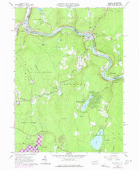
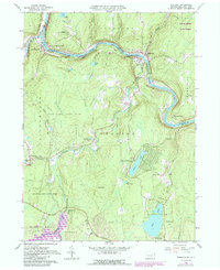
1965 Map of Shohola
USGS Topo · Published 1977About this map
The Delaware River carves a winding path through the borderlands of Pennsylvania and New York, anchoring the riverfront settlements of Lackawaxen, Shohola, and Barryville. This mid-1960s landscape, later updated in 1973, reveals a community built around the water and the Erie-Lackawanna railroad line. Cultural and local history is deeply etched into the terrain, from the Minisink Battlefield Memorial overlooking the valley to the small rural congregations of St Anns Ch and St Jacobs Ch.
Find a feature on this map
59 named features on this map. Tap any name to fly to it.
Don’t see what you’re looking for? This feature index may not catch every label — zoom into the map to look around manually.
Map Details
Editions of this 1965 Shohola Map
5 editions found
Other maps of this area

1913 · Milford
USGS Topo · 1:62,500

1915 · Milford
USGS Topo · 1:62,500

1920 · Damascus
USGS Topo · 1:62,500

1922 · White Lake
USGS Topo · 1:62,500

1923 · Damascus
USGS Topo · 1:62,500

1935 · Hawley
USGS Topo · 1:62,500

1938 · Hawley
USGS Topo · 1:62,500

1942 · White Lake
USGS Topo · 1:62,500

1943 · Honesdale
USGS Topo · 1:125,000

1943 · White Lake
USGS Topo · 1:62,500