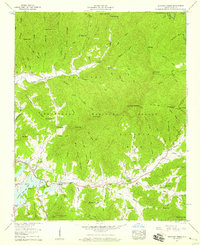
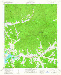
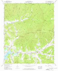
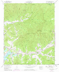
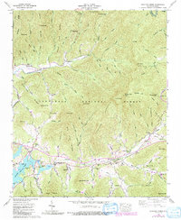
1957 Map of Shooting Creek
USGS Topo · Published 1959About this map
Chatuge Lake dominates the southwest corner of this mountain landscape, where the waters of Shooting Creek meet the reservoir at the base of Galloway Mountain. The settlement pattern in the late 1950s follows the narrow valley floors, anchored by local institutions like Marshall Chapel, Shooting Creek School, and the Old Shooting Creek Ch. A secondary concentration of homesteads and the Tusquitee Ch sits to the north along Tusquitee Creek, separated from the main valley by the high ridge of Piney Top and Stamey Knob.
Find a feature on this map
108 named features on this map. Tap any name to fly to it.
Don’t see what you’re looking for? This feature index may not catch every label — zoom into the map to look around manually.
Map Details
Editions of this 1957 Shooting Creek Map
5 editions found
Other maps of this area

1886 · Dahlonega
USGS Topo · 1:125,000

1892 · Dahlonega
USGS Topo · 1:125,000

1896 · Dahlonega
USGS Topo · 1:125,000

1903 · Dahlonega
USGS Topo · 1:125,000

1935 · Osborn
USGS Topo · 1:24,000

1935 · Rainbow Springs
USGS Topo · 1:24,000
1935 · Shooting Creek
USGS Topo · 1:24,000

1935 · Burningtown Bald
USGS Topo · 1:24,000

1935 · Topton
USGS Topo · 1:24,000

1935 · Wayah Bald
USGS Topo · 1:48,000