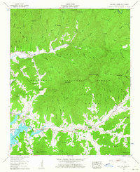
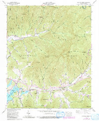
1957 Map of Shooting Creek
USGS Topo · Published 1964About this map
Chatuge Lake dominates the southwestern corner of this survey, where the waters reach into the southern Appalachian valleys during the mid-1950s. The settlement of Shooting Creek serves as a central hub for the surrounding rural communities, characterized by a high density of country churches and schools that define the local social fabric. Significant landmarks like the Old Shooting Creek Ch and the Shooting Creek School stand near the banks of the creek, while the Galloway Hill Cem provides a point of interest for those tracing family history in Clay County.
Find a feature on this map
113 named features on this map. Tap any name to fly to it.
Don’t see what you’re looking for? This feature index may not catch every label — zoom into the map to look around manually.
Map Details
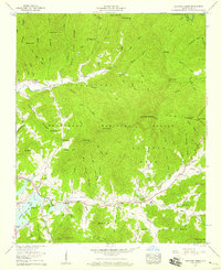
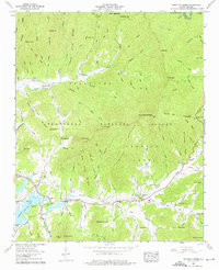
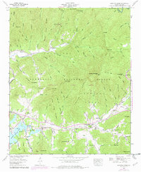
Editions of this 1957 Shooting Creek Map
5 editions found
Other maps of this area

1886 · Dahlonega
USGS Topo · 1:125,000

1892 · Dahlonega
USGS Topo · 1:125,000

1896 · Dahlonega
USGS Topo · 1:125,000

1903 · Dahlonega
USGS Topo · 1:125,000

1935 · Osborn
USGS Topo · 1:24,000

1935 · Rainbow Springs
USGS Topo · 1:24,000
1935 · Shooting Creek
USGS Topo · 1:24,000

1935 · Burningtown Bald
USGS Topo · 1:24,000

1935 · Topton
USGS Topo · 1:24,000

1935 · Wayah Bald
USGS Topo · 1:48,000