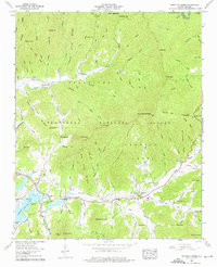
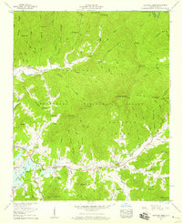
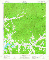
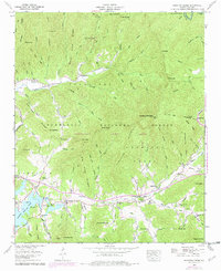
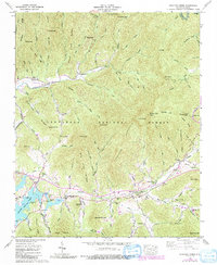
1957 Map of Shooting Creek
USGS Topo · Published 1975About this map
Chatuge Lake defines the western edge of this mountain landscape, its shoreline reaching into the valleys where small communities like Shooting Creek and Old Shooting Creek are established. The 1957 topography reveals a dense network of mountain ridges, including Tusquitee Mountain and Chunky Gal Mountain, within the Nantahala National Forest. Settlers and farmers concentrated along the drainage of Shooting Creek, supported by several local congregations such as Bethel Church, Bethabara Church, and Marshall Chapel. Evidence of early industry and commerce appears through the Copper Mine on Big Pine Ridge and the Shooting Creek School. The map also captures numerous family-named coves and gaps, such as Chairmaker Cove, Joe Cove, and Glade Gap, illustrating how the difficult terrain shaped the local geography and social centers before major mid-century developments.
Find a feature on this map
101 named features on this map. Tap any name to fly to it.
Don’t see what you’re looking for? This feature index may not catch every label — zoom into the map to look around manually.
Map Details
Editions of this 1957 Shooting Creek Map
5 editions found
Other maps of this area

1886 · Dahlonega
USGS Topo · 1:125,000

1892 · Dahlonega
USGS Topo · 1:125,000

1896 · Dahlonega
USGS Topo · 1:125,000

1903 · Dahlonega
USGS Topo · 1:125,000

1935 · Osborn
USGS Topo · 1:24,000

1935 · Rainbow Springs
USGS Topo · 1:24,000
1935 · Shooting Creek
USGS Topo · 1:24,000

1935 · Burningtown Bald
USGS Topo · 1:24,000

1935 · Topton
USGS Topo · 1:24,000

1935 · Wayah Bald
USGS Topo · 1:48,000