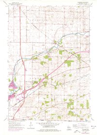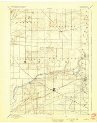
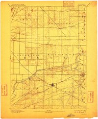
1893 Map of Shopiere
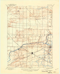
USGS Topo · Published 1933About this map
Clinton Junction serves as the primary transportation hub on this late 19th-century landscape, situated at the busy intersection of the Chicago Milwaukee and St. Paul Railroad and the Chicago and Northwestern Railroad. This rail network defines the local economy, connecting smaller agricultural settlements like Allen Grove and Shopiere to wider markets. The winding path of Turtle Creek meanders through the townships of Turtle, Bradford, and Rock, providing a natural contrast to the rigid grid of section lines and township boundaries. In the north, Johnstown Center and Johnstown remain established rural centers, while the distinction between the village of Shopiere and the nearby Shopiere Depot illustrates how the arrival of steam power could shift a town's center of gravity toward the tracks.
Find a feature on this map
22 named features on this map. Tap any name to fly to it.
Don’t see what you’re looking for? This feature index may not catch every label — zoom into the map to look around manually.
Map Details
Editions of this 1893 Shopiere Map
5 editions found

Historical Maps of Janesville Through Time
8 maps found