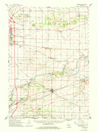
1961 Map of Shopiere
USGS Topo · Published 1982About this map
Clinton Junction and the surrounding Rock County agricultural lands are defined by the convergence of major rail lines, including the Chicago Milwaukee St Paul and Pacific and the Chicago and North Western railroads. These transit corridors dictated the growth of rural nodes like Shopiere, Avalon, and Tiffany. The landscape is a network of small schoolhouses such as La Prairie Sch and Kemmerer Sch, alongside numerous country cemeteries including Bradford Cem and Clinton Corners Cem.
Find a feature on this map
64 named features on this map. Tap any name to fly to it.
Don’t see what you’re looking for? This feature index may not catch every label — zoom into the map to look around manually.
Map Details
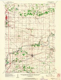
Editions of this 1961 Shopiere Map
2 editions found
Other maps of this area

1890 · Stoughton
USGS Topo · 1:62,500

1891 · Koshkonong
USGS Topo · 1:62,500

1891 · Janesville
USGS Topo · 1:62,500

1892 · Whitewater
USGS Topo · 1:62,500

1893 · Delavan
USGS Topo · 1:62,500

1893 · Whitewater
USGS Topo · 1:62,500

1893 · Janesville
USGS Topo · 1:62,500

1893 · Shopiere
USGS Topo · 1:62,500

1894 · Koshkonong
USGS Topo · 1:62,500

1903 · Whitewater
USGS Topo · 1:62,500