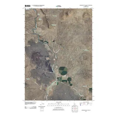
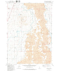
2010 Map of Shoshone Ice Cave
USGS Topo · Published 2010About this map
The Big Wood River carves a winding path through this desert landscape, its waters diverted into a complex network of irrigation infrastructure essential to the region's agricultural life. The massive Richfield Main Canal and the Lincoln Bypass Canal dominate the central terrain, while the settlement of Burmah sits near the southern edge of the sheet. This system of water management is further evidenced by numerous storage basins including Reservoir Number Ninety-Three, Trestle Reservoir, and Culvert Reservoir.
Find a feature on this map
26 named features on this map. Tap any name to fly to it.
Don’t see what you’re looking for? This feature index may not catch every label — zoom into the map to look around manually.
Map Details
Editions of this 2010 Shoshone Ice Cave Map
This is the sole edition of this map. No revisions or reprints were ever made.
Other maps of this area

1955 · Hailey
USGS Topo · 1:250,000

1957 · Bellevue
USGS Topo · 1:62,500

1959 · Hailey
USGS Topo · 1:250,000

1962 · Hailey
USGS Topo · 1:250,000
1979 · Richfield
USGS Topo · 1:24,000

1979 · Shoshone Ice Cave
USGS Topo · 1:24,000
1979 · Tapper Lake
USGS Topo · 1:24,000
1979 · Gannett
USGS Topo · 1:24,000
1979 · Kinzie Butte
USGS Topo · 1:24,000

1979 · Summit Reservoir
USGS Topo · 1:24,000