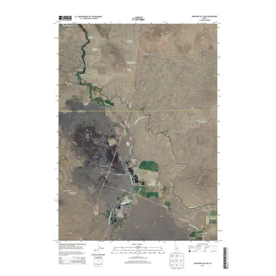
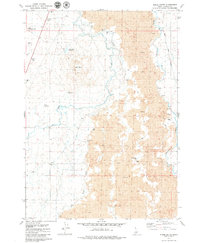
2013 Map of Shoshone Ice Cave
USGS Topo · Published 2013About this map
Shoshone Ice Cave and the distinct volcanic form of Black Butte Crater anchor this high-desert landscape in southern Idaho. The area is defined by a complex network of water management, where the Big Wood River is diverted into numerous channels including the Richfield Main Canal, the Lincoln-Bypass Canal, and Cottonwood Slough. This system of reservoirs and laterals, such as Trestle Reservoir and Lateral 156, supports the arid terrain surrounding the small settlement of Burmah. Significant topographical landmarks rise above the canal-fed plains, notably Dinosaur Ridge and Wedge Butte, which provide vertical contrast to the desert roads like Burma Rd and Buck Lake Desert Rd. This map captures a modern view of how agricultural infrastructure interacts with the region's geological features.
Find a feature on this map
36 named features on this map. Tap any name to fly to it.
Don’t see what you’re looking for? This feature index may not catch every label — zoom into the map to look around manually.
Map Details
Editions of this 2013 Shoshone Ice Cave Map
This is the sole edition of this map. No revisions or reprints were ever made.
Other maps of this area

1955 · Hailey
USGS Topo · 1:250,000

1957 · Bellevue
USGS Topo · 1:62,500

1959 · Hailey
USGS Topo · 1:250,000

1962 · Hailey
USGS Topo · 1:250,000
1979 · Richfield
USGS Topo · 1:24,000

1979 · Shoshone Ice Cave
USGS Topo · 1:24,000
1979 · Tapper Lake
USGS Topo · 1:24,000
1979 · Gannett
USGS Topo · 1:24,000
1979 · Kinzie Butte
USGS Topo · 1:24,000

1979 · Summit Reservoir
USGS Topo · 1:24,000