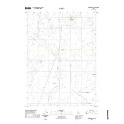
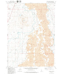
2020 Map of Shoshone Ice Cave
USGS Topo · Published 2020About this map
The Big Wood River carves through this high desert terrain at the boundary of Blaine and Lincoln Counties, revealing a landscape defined by volcanic geology and intensive water management. The presence of Black Butte Crater and Wedge Butte highlights the area's volcanic origins, while a complex network of man-made waterways like the Richfield Main Canal, Richfield Canal, and Lincoln Bypass Canal illustrates the effort to reclaim this arid land for agriculture. Near the small settlement of Burmah, the intersection of Old Hwy 93 and various irrigation channels like Lateral 156 and Cottonwood Slough demonstrates the local reliance on the river's flow. Further north, specialized infrastructure including Trestle Reservoir and Culvert Reservoir near Dinosaur Ridge serves the Picabo Desert region, supporting a mix of ranching and desert access through routes like W Magic Rd and Burma Rd.
Find a feature on this map
30 named features on this map. Tap any name to fly to it.
Don’t see what you’re looking for? This feature index may not catch every label — zoom into the map to look around manually.
Map Details
Editions of this 2020 Shoshone Ice Cave Map
This is the sole edition of this map. No revisions or reprints were ever made.
Other maps of this area

1955 · Hailey
USGS Topo · 1:250,000

1957 · Bellevue
USGS Topo · 1:62,500

1959 · Hailey
USGS Topo · 1:250,000

1962 · Hailey
USGS Topo · 1:250,000
1979 · Richfield
USGS Topo · 1:24,000

1979 · Shoshone Ice Cave
USGS Topo · 1:24,000
1979 · Tapper Lake
USGS Topo · 1:24,000
1979 · Gannett
USGS Topo · 1:24,000
1979 · Kinzie Butte
USGS Topo · 1:24,000

1979 · Summit Reservoir
USGS Topo · 1:24,000