
1970 Map of Shovel Lake
USGS Topo · Published 1972About this map
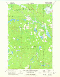
Chippewa National Forest and the Land O' Lakes State Forest dominate this section of the northern Minnesota lake country. The landscape is a complex network of wetlands and small glacial lakes, including Shovel Lake, Little Thunder Lake, and Whiskey Lake. The Soo Line railroad cuts across the northeastern corner, passing the small community area near Shovel Lake, where a Townhall and Lakeview Cem are situated. This 1970s survey captures a wilderness-adjacent region defined by its timber and recreation potential, showing an extensive Snowmobile Trail winding through the forested terrain. The drainage patterns of the Willow River and Moose River illustrate the slow-moving, meandering water systems typical of the area before modern intensive development.
Find a feature on this map
28 named features on this map. Tap any name to fly to it.
Don’t see what you’re looking for? This feature index may not catch every label — zoom into the map to look around manually.
Map Details
Editions of this 1970 Shovel Lake Map
2 editions found
Other maps of this area

1953 · Duluth
USGS Topo · 1:250,000

1954 · Hibbing
USGS Topo · 1:250,000

1957 · Hibbing
USGS Topo · 1:250,000

1958 · Hibbing
USGS Topo · 1:250,000

1958 · Duluth
USGS Topo · 1:250,000

1964 · Hibbing
USGS Topo · 1:250,000

1970 · Edna Lake
USGS Topo · 1:24,000

1970 · Big Thunder Peak
USGS Topo · 1:24,000
1970 · Roosevelt Lake
USGS Topo · 1:24,000
1970 · Thunder Lake
USGS Topo · 1:24,000