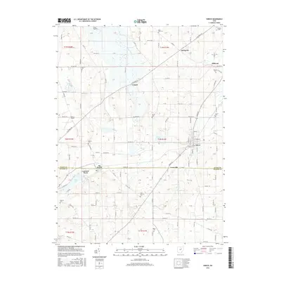
2016 Map of Shreve
USGS Topo · Published 2016About this map
Shreve serves as the primary hub of this landscape, situated at the crossroads of Shreve Rd and several county routes. The surrounding area is defined by a series of glacial lakes and wetlands, including the expansive Funk Bottoms to the north and the Killbuck Swamp on the eastern edge. For genealogists and local historians, the sheet is particularly valuable for its documentation of numerous small burial grounds such as Ripley Township Cem, Manley Cem, and Newkirk Cem, which are scattered throughout the townships. Smaller settlements like Big Prairie and the lakeside community of Lakeland Beach on Odell Lake show the distribution of population outside the main village centers. Significant water features like Shreve Lake, Brown Lake, and Lake Wapusun punctuate the grid of township roads, illustrating the drainage patterns into Kiser Ditch and Shreve Cr.
Find a feature on this map
103 named features on this map. Tap any name to fly to it.
Don’t see what you’re looking for? This feature index may not catch every label — zoom into the map to look around manually.
Map Details
Editions of this 2016 Shreve Map
This is the sole edition of this map. No revisions or reprints were ever made.
Other maps of this area

1901 · Wooster
USGS Topo · 1:62,500

1903 · Wooster
USGS Topo · 1:62,500

1906 · West Salem
USGS Topo · 1:62,500

1908 · West Salem
USGS Topo · 1:62,500

1912 · Loudonville
USGS Topo · 1:62,500

1914 · Loudonville
USGS Topo · 1:62,500

1915 · Millersburg
USGS Topo · 1:62,500

1943 · Millersburg
USGS Topo · 1:62,500

1943 · Loudonville
USGS Topo · 1:62,500

1950 · Marion
USGS Topo · 1:250,000