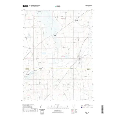
2019 Map of Shreve
USGS Topo · Published 2019About this map
The village of Shreve serves as a central hub on this 2019 survey, surrounded by a complex landscape of glacial kettles and marshlands at the Wayne and Holmes County line. The map captures a high concentration of cemeteries including Millbrook Cem, Fairview Cem, and Ripley Township Cem, providing essential data for genealogical research in this rural pocket of Ohio. To the west and north, the terrain is defined by significant water and wetland features such as Funk Bottoms, the Killbuck Swamp, and the recreationally significant Odell Lake at Lakeland Beach. Smaller settlements like Big Prairie, Springville, and Lakeville are linked by a dense network of township and county roads, reflecting the long-established agricultural and community patterns of the region. Distinctive landmarks like the Mohican Airpark and the state wildlife area at Shreve Lake highlight the area's mix of private land use and conservation.
Find a feature on this map
103 named features on this map. Tap any name to fly to it.
Don’t see what you’re looking for? This feature index may not catch every label — zoom into the map to look around manually.
Map Details
Editions of this 2019 Shreve Map
This is the sole edition of this map. No revisions or reprints were ever made.
Other maps of this area

1901 · Wooster
USGS Topo · 1:62,500

1903 · Wooster
USGS Topo · 1:62,500

1906 · West Salem
USGS Topo · 1:62,500

1908 · West Salem
USGS Topo · 1:62,500

1912 · Loudonville
USGS Topo · 1:62,500

1914 · Loudonville
USGS Topo · 1:62,500

1915 · Millersburg
USGS Topo · 1:62,500

1943 · Millersburg
USGS Topo · 1:62,500

1943 · Loudonville
USGS Topo · 1:62,500

1950 · Marion
USGS Topo · 1:250,000