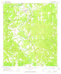
1964 Map of Shubuta
USGS Topo · Published 1981About this map
The Chickasawhay River winds through this mid-1960s landscape, serving as a central artery for the settlements of Shubuta and Hiwannee. This era shows a community structured by both its natural waterways and the industrial reach of the Gulf Mobile and Ohio railroad. A significant historical line, the Old Indian Treaty Boundary, cuts across the terrain, marking an older chapter of land division and settlement history.
Find a feature on this map
55 named features on this map. Tap any name to fly to it.
Don’t see what you’re looking for? This feature index may not catch every label — zoom into the map to look around manually.
Map Details
Editions of this 1964 Shubuta Map
2 editions found
Other maps of this area

1953 · Hattiesburg
USGS Topo · 1:250,000

1958 · Hattiesburg
USGS Topo · 1:250,000

1964 · Carmichael
USGS Topo · 1:24,000

1964 · Denham
USGS Topo · 1:24,000

1964 · Eucutta
USGS Topo · 1:24,000

1964 · Hale
USGS Topo · 1:24,000

1964 · De Soto
USGS Topo · 1:24,000

1964 · Waynesboro
USGS Topo · 1:24,000

1964 · Whistler
USGS Topo · 1:24,000

1964 · Shubuta
USGS Topo · 1:24,000