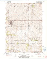
1952 Map of Shullsburg
USGS Topo · Published 1991About this map
The lead-mining heritage of Lafayette County is etched into the landscape around Shullsburg and Dunbarton in the early 1950s. Mining activity is evident through numerous features like the Calumet and Hecla Mine Mine Dump, scattered Inactive Mines, and several Quarries, illustrating an economy transitioning from its industrial peak. The Chicago Milwaukee St. Paul and Pacific railroad bisects the terrain, providing a vital link for the region's mineral and agricultural exports.
Find a feature on this map
32 named features on this map. Tap any name to fly to it.
Don’t see what you’re looking for? This feature index may not catch every label — zoom into the map to look around manually.
Map Details
Editions of this 1952 Shullsburg Map
2 editions found
Other maps of this area

1902 · Mineral Point
USGS Topo · 1:125,000

1911 · Elizabeth
USGS Topo · 1:62,500

1911 · Galena
USGS Topo · 1:62,500

1913 · Galena
USGS Topo · 1:62,500

1936 · Elizabeth
USGS Topo · 1:62,500

1952 · Shullsburg
USGS Topo · 1:24,000

1952 · Calamine
USGS Topo · 1:24,000

1952 · Belmont
USGS Topo · 1:24,000

1952 · New Diggings
USGS Topo · 1:24,000

1959 · Dubuque
USGS Topo · 1:250,000