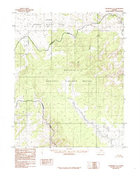
1985 Map of Shungnak A-5
USGS Topo · Published 1985About this map
The Continental Divide creates a sharp geographical boundary across this interior Alaskan landscape, separating the drainage systems of the north and south. Within this high-altitude environment, the boundaries of two major conservation areas meet: the Selawik National Wildlife Refuge and the Koyukuk National Wildlife Refuge. These federal reservations, established by the Alaska National Interest Lands Conservation Act shortly before this survey, preserve the vast habitats surrounding the headwaters of the Huslia River and its North Fork. The map provides a look at a transitional wilderness where the high terrain of the divide drops into the river-cut valleys that define the regional ecology of the Yukon-Koyukuk area.
Find a feature on this map
5 named features on this map. Tap any name to fly to it.
Don’t see what you’re looking for? This feature index may not catch every label — zoom into the map to look around manually.
Map Details
Editions of this 1985 Shungnak A-5 Map
This is the sole edition of this map. No revisions or reprints were ever made.
Other maps of this area

1951 · Shungnak
USGS Topo · 1:250,000

1951 · Kateel River
USGS Topo · 1:250,000

1954 · Kateel River D-4
USGS Topo · 1:63,360

1954 · Kateel River D-6
USGS Topo · 1:63,360

1954 · Kateel River D-5
USGS Topo · 1:63,360

1955 · Shungnak
USGS Topo · 1:250,000

1955 · Kateel River
USGS Topo · 1:250,000

1964 · Shungnak
USGS Topo · 1:250,000

1985 · Shungnak B-4
USGS Topo · 1:63,360
1985 · Shungnak B-6
USGS Topo · 1:63,360