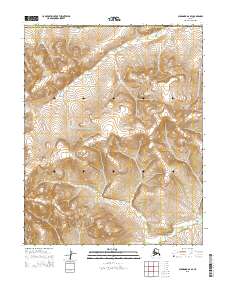
2015 Map of Shungnak A-6 SE
USGS Topo · Published 2015About this map
The Continental Divide winds through this high-latitude terrain, marking a fundamental geographic boundary in the Alaskan interior. This 2015 survey, compiled by the U.S. Geological Survey and the Alaska Dept. of Transportation, highlights the remote and unpopulated intersection where the Northwest Arctic Borough meets the Yukon-Koyukuk Census Area. The landscape is defined entirely by its complex topography and drainage patterns, absent of any named roads or permanent settlements. The map provides a precise look at the township grid systems of T8N R1E and T8N R2E, where the high ridges of the divide dictate the flow of seasonal water into the surrounding basins. This is a purely natural record of the wilderness, essential for understanding the physical geography of the Shungnak region during the early twenty-first century.
Find a feature on this map
6 named features on this map. Tap any name to fly to it.
Don’t see what you’re looking for? This feature index may not catch every label — zoom into the map to look around manually.
Map Details
Editions of this 2015 Shungnak A-6 SE Map
This is the sole edition of this map. No revisions or reprints were ever made.
Other maps of this area

1951 · Shungnak
USGS Topo · 1:250,000

1951 · Kateel River
USGS Topo · 1:250,000

1954 · Kateel River D-6
USGS Topo · 1:63,360

1954 · Kateel River D-5
USGS Topo · 1:63,360

1955 · Shungnak
USGS Topo · 1:250,000

1955 · Kateel River
USGS Topo · 1:250,000

1964 · Shungnak
USGS Topo · 1:250,000
1985 · Shungnak A-5
USGS Topo · 1:63,360
1985 · Shungnak A-6
USGS Topo · 1:63,360
2015 · Kateel River D-6 NE
USGS Topo · 1:25,000