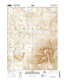
2016 Map of Shungnak C-4 SW
USGS Topo · Published 2016About this map
The Kiliovilik Range dominates the southeastern quadrant of this terrain, where steep elevation gradients rise above the surrounding basin. This 2016 survey, produced using data from the U.S. Geological Survey and the Alaska Department of Transportation, illustrates the transition from the high ridges of the range to the lower-lying wetlands and hydrographic networks that define the northern sections of the map. The landscape is structured by the Public Land Survey System, with township boundaries for t14n r4e, t14n r5e, t13n r4e, and t13n r5e providing a formal grid over the remote Arctic terrain. This map serves as a primary record of the topographic character of this portion of the Northwest Arctic Borough in the early twenty-first century.
Find a feature on this map
5 named features on this map. Tap any name to fly to it.
Don’t see what you’re looking for? This feature index may not catch every label — zoom into the map to look around manually.
Map Details
Editions of this 2016 Shungnak C-4 SW Map
This is the sole edition of this map. No revisions or reprints were ever made.
Other maps of this area

1951 · Shungnak
USGS Topo · 1:250,000

1955 · Shungnak
USGS Topo · 1:250,000

1964 · Shungnak
USGS Topo · 1:250,000

1985 · Shungnak B-4
USGS Topo · 1:63,360
1985 · Shungnak B-5
USGS Topo · 1:63,360
1985 · Shungnak C-5
USGS Topo · 1:63,360
1985 · Shungnak C-4
USGS Topo · 1:63,360
2016 · Shungnak C-5 NE
USGS Topo · 1:25,000
2016 · Shungnak C-5 SE
USGS Topo · 1:25,000
2016 · Shungnak B-5 NE
USGS Topo · 1:25,000