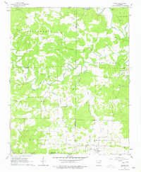
1962 Map of Sidney
USGS Topo · Published 1979About this map
The Strawberry River and its complex network of tributaries like the Piney Fork and Bear Creek define this rural landscape on the border of Izard and Sharp Counties. In the early 1960s, the area remained a network of upland ridges and creek bottoms, anchored by the town of Evening Shade and the smaller settlement of Sidney. The map reveals the deep roots of these Ozark foothills communities through a density of family-linked landmarks and social hubs, such as the Yeager Cem, Williams Cem, and Antioch Ch. Notably, a simple Schoolhouse remains near the settlement of Needmore, while terrain features like The Backbone and Pleasant Hill illustrate the winding routes required for travel between the river valleys. Local industry is represented by the Gravel Hill Gravel Pits, providing insight into the material extraction used for the region's development.
Find a feature on this map
39 named features on this map. Tap any name to fly to it.
Don’t see what you’re looking for? This feature index may not catch every label — zoom into the map to look around manually.
Map Details
Editions of this 1962 Sidney Map
2 editions found
Other maps of this area

1890 · Batesville
USGS Topo · 1:125,000

1891 · Batesville
USGS Topo · 1:125,000

1942 · Mt Pleasant
USGS Topo · 1:31,680

1943 · Sandtown
USGS Topo · 1:24,000

1943 · Cave City
USGS Topo · 1:31,680

1951 · Melbourne
USGS Topo · 1:62,500

1953 · Memphis
USGS Topo · 1:250,000

1956 · Memphis
USGS Topo · 1:250,000

1957 · Poplar Bluff
USGS Topo · 1:250,000

1959 · Poplar Bluff
USGS Topo · 1:250,000