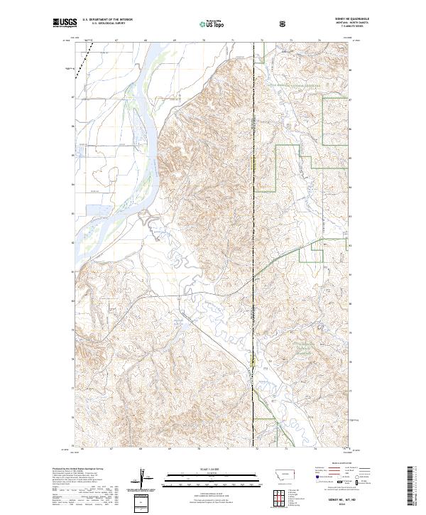
2024 Map of Sidney NE
USGS Topo · Published 2024About this map
The Yellowstone River cuts through the western edge of this landscape, marking a transition from the river valley into the broken terrain of the Little Missouri National Grassland. Stretching across the Montana and North Dakota border, the map reveals a rugged network of drainage systems including Bennie Peer Creek and Cheney Creek. This rural boundary zone between Richland County, Montana, and McKenzie County, North Dakota, is defined by its topographic complexity, where numerous coulees like Estes Coulee and water sources such as Estes Spring and McGlynn Reservoir support the region's agricultural and grazing lands. A sparse network of local routes, including Bennie Peer Rd and Co Rd 122, provides the primary access through these expansive grasslands.
Find a feature on this map
25 named features on this map. Tap any name to fly to it.
Don’t see what you’re looking for? This feature index may not catch every label — zoom into the map to look around manually.
Map Details
Editions of this 2024 Sidney NE Map
This is the sole edition of this map. No revisions or reprints were ever made.
Other maps of this area

1909 · Glendive
USGS Topo · 1:250,000

1953 · Watford City
USGS Topo · 1:250,000

1954 · Glendive
USGS Topo · 1:250,000

1957 · Glendive
USGS Topo · 1:250,000

1957 · Watford City
USGS Topo · 1:250,000

1958 · Glendive
USGS Topo · 1:250,000

1966 · Piche
USGS Topo · 1:24,000

1966 · Sidney NE
USGS Topo · 1:24,000

1966 · Sidney
USGS Topo · 1:24,000

1967 · Watford City
USGS Topo · 1:250,000