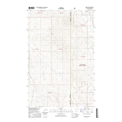
2017 Map of Sidney SE
USGS Topo · Published 2017About this map
The Little Missouri National Grassland dominates the eastern portion of this landscape, marking a transition across the state line where the high plains of Montana meet the rugged breaks of North Dakota. This 2017 survey by the U.S. Geological Survey captures a sparsely populated ranching and public land region defined by a network of seasonal drainages and section-line roads. Waterways like Devils Cr and O'Brien Cr carve through the terrain, feeding towards larger basins outside the quadrangle. In the northeast, Bennie Peer Cr and its namesake Bennie Peer Rd indicate early local land use patterns that persisted into the twenty-first century. The presence of the Lmng and labels for One O One Rd reflect the enduring character of this borderland, where the traditional township and range system remains the primary framework for navigation and property.
Find a feature on this map
22 named features on this map. Tap any name to fly to it.
Don’t see what you’re looking for? This feature index may not catch every label — zoom into the map to look around manually.
Map Details
Editions of this 2017 Sidney SE Map
This is the sole edition of this map. No revisions or reprints were ever made.
Other maps of this area

1909 · Glendive
USGS Topo · 1:250,000

1953 · Watford City
USGS Topo · 1:250,000

1954 · Glendive
USGS Topo · 1:250,000

1957 · Glendive
USGS Topo · 1:250,000

1957 · Watford City
USGS Topo · 1:250,000

1958 · Glendive
USGS Topo · 1:250,000

1966 · Piche
USGS Topo · 1:24,000

1966 · Sidney NE
USGS Topo · 1:24,000

1966 · Skaar NW
USGS Topo · 1:24,000

1966 · Sidney
USGS Topo · 1:24,000