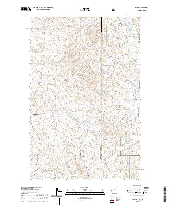
2024 Map of Sidney SE
USGS Topo · Published 2024About this map
Little Missouri National Grassland dominates the eastern portion of this landscape, where the high plains of eastern Montana meet the badlands of western North Dakota. The state line between Montana and North Dakota bisects the terrain, which is defined by a network of drainage systems cutting through the prairie. Watercourses such as O'Brien Creek, Bennie Peer Creek, and One-O-One Creek shape the topography, creating a series of draws and ridges that dictated the placement of early ranching roads like Bennie Peer Rd and One O One Rd. This 2024 survey reflects the modern management of these public lands while preserving the historical survey grid lines of t21n r60e and t147n r105w. The intersection of Richland and McKenzie counties illustrates the sparse but critical transportation network, including Co Rd 116, that connects the isolated drainages of Devils Creek and Alkali Creek to the broader region.
Find a feature on this map
22 named features on this map. Tap any name to fly to it.
Don’t see what you’re looking for? This feature index may not catch every label — zoom into the map to look around manually.
Map Details
Editions of this 2024 Sidney SE Map
This is the sole edition of this map. No revisions or reprints were ever made.
Other maps of this area

1909 · Glendive
USGS Topo · 1:250,000

1953 · Watford City
USGS Topo · 1:250,000

1954 · Glendive
USGS Topo · 1:250,000

1957 · Glendive
USGS Topo · 1:250,000

1957 · Watford City
USGS Topo · 1:250,000

1958 · Glendive
USGS Topo · 1:250,000

1966 · Piche
USGS Topo · 1:24,000

1966 · Sidney NE
USGS Topo · 1:24,000

1966 · Skaar NW
USGS Topo · 1:24,000

1966 · Sidney
USGS Topo · 1:24,000