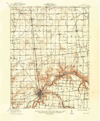
1913 Map of Sidney
USGS Topo · Published 1934About this map
Sidney serves as the industrial and transportation hub of Shelby County on this 1913 survey, where the Miami River meets an intricate network of early twentieth-century infrastructure. The presence of the Miami and Erie Canal and its associated Feeder Canal highlights a lingering era of water-driven commerce even as four major rail lines, including the Western Ohio Electric RR and the Cincinnati Hamilton and Dayton RR, redefined the region's connectivity.
Find a feature on this map
75 named features on this map. Tap any name to fly to it.
Don’t see what you’re looking for? This feature index may not catch every label — zoom into the map to look around manually.
Map Details
Editions of this 1913 Sidney Map
2 editions found
Other maps of this area

1906 · Lima
USGS Topo · 1:62,500

1909 · Loramie
USGS Topo · 1:62,500

1911 · Loramie
USGS Topo · 1:62,500

1911 · Spencerville
USGS Topo · 1:62,500

1911 · Covington
USGS Topo · 1:62,500

1913 · Alger
USGS Topo · 1:48,000

1913 · Bellefontaine
USGS Topo · 1:48,000

1913 · Sidney
USGS Topo · 1:62,500

1914 · Troy
USGS Topo · 1:62,500

1914 · St. Paris
USGS Topo · 1:62,500