
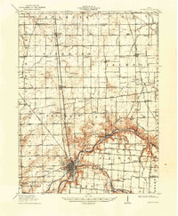
1913 Map of Sidney
USGS Topo · Published 1934About this map
Sidney serves as the industrial and transportation hub of this West Central Ohio landscape, where the Miami and Erie Canal traces the valley alongside the Miami River. This 1911 survey captures the region's dense network of early 20th-century infrastructure, featuring multiple competing rail lines such as the Cincinnati Hamilton and Dayton RR and the electric Western Ohio RR. A significant historical boundary, the Greenville Treaty Line, cuts diagonally through the townships of Dinsmore and Franklin, marking a legacy of frontier-era land division that persists in the modern road grid. Outside the primary settlements like Jackson Center and Anna, the countryside is dotted with numbered district schools and family-named landmarks like Cooks School and Metz School, reflecting a settled, agricultural society at its height before the widespread consolidation of rural institutions.
Find a feature on this map
70 named features on this map. Tap any name to fly to it.
Don’t see what you’re looking for? This feature index may not catch every label — zoom into the map to look around manually.
Map Details
Editions of this 1913 Sidney Map
2 editions found
Other maps of this area

1906 · Lima
USGS Topo · 1:62,500

1909 · Loramie
USGS Topo · 1:62,500

1911 · Loramie
USGS Topo · 1:62,500

1911 · Spencerville
USGS Topo · 1:62,500

1911 · Covington
USGS Topo · 1:62,500

1913 · Alger
USGS Topo · 1:48,000

1913 · Bellefontaine
USGS Topo · 1:48,000

1914 · Troy
USGS Topo · 1:62,500

1914 · St. Paris
USGS Topo · 1:62,500

1915 · Alger
USGS Topo · 1:62,500