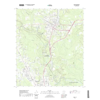
2019 Map of Silsbee
USGS Topo · Published 2019About this map
Lumberton and Silsbee anchor this 2019 survey of the Hardin County landscape, where residential growth meets the protected wetlands of the Big Thicket National Preserve. The area's timber and transport legacy is visible in the network of the BNSF Railway and water features like Old Mill Pond and Walton Creek. Local genealogy is well-represented through numerous burial grounds, including Peaceful Rest Cemetery, Hook Cemetery, and Knupple Cemetery. The map captures a complex hydrological system defined by Village Creek and its many offshoots, such as Little Bellrose Slough and Sandy Slough, which weave through the dense bottoms. Small settlements like Fletcher and Seth sit along the primary corridors, illustrating the historical development patterns between the larger towns. Researchers can also find family-named landmarks and local water bodies like Patterson Lake and Harper Pond that characterize the Piney Woods region.
Find a feature on this map
206 named features on this map. Tap any name to fly to it.
Don’t see what you’re looking for? This feature index may not catch every label — zoom into the map to look around manually.
Map Details
Editions of this 2019 Silsbee Map
This is the sole edition of this map. No revisions or reprints were ever made.
Other maps of this area

1926 · Lakeview
USGS Topo · 1:24,000

1932 · Beaumont
USGS Topo · 1:62,500

1954 · Beaumont
USGS Topo · 1:250,000

1955 · Silsbee
USGS Topo · 1:62,500

1955 · Kountze
USGS Topo · 1:62,500

1955 · Sour Lake
USGS Topo · 1:62,500

1957 · Beaumont
USGS Topo · 1:250,000
1960 · Voth
USGS Topo · 1:24,000
1960 · Pine Forest
USGS Topo · 1:24,000

1984 · Beaumont
USGS Topo · 1:250,000