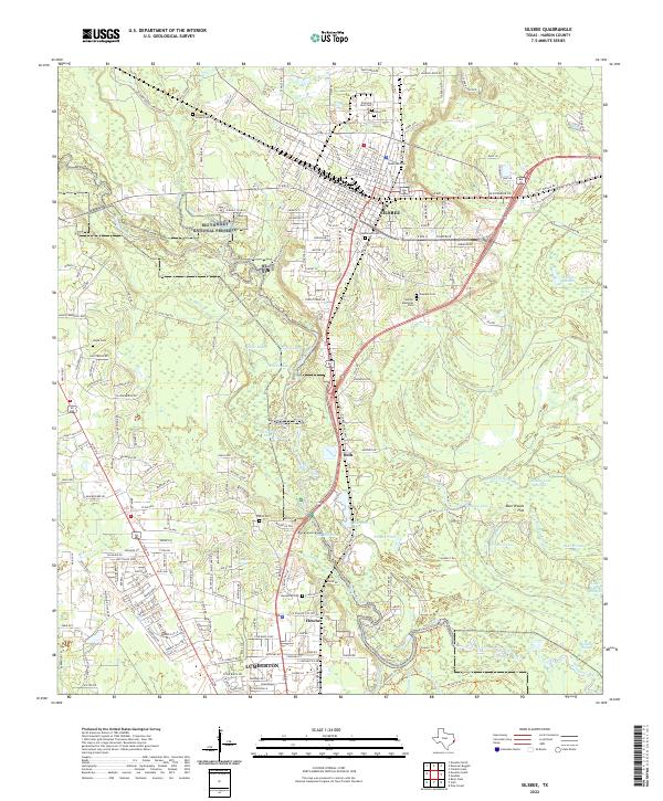
2022 Map of Silsbee
USGS Topo · Published 2022About this map
Silsbee and the neighboring community of Lumberton anchor this survey of the East Texas piney woods, where the landscape is defined by the winding course of Village Creek. The map documents a corridor of residential growth along the rail lines and highways connecting these centers, passing through smaller settlements like Seth and Fletcher. The natural character of the region is preserved within the Big Thicket National Preserve, which protects a complex network of wetlands and waterways including Clear Lake, Yellow Lake, and Round Lake.
Find a feature on this map
220 named features on this map. Tap any name to fly to it.
Don’t see what you’re looking for? This feature index may not catch every label — zoom into the map to look around manually.
Map Details
Editions of this 2022 Silsbee Map
This is the sole edition of this map. No revisions or reprints were ever made.
Other maps of this area

1926 · Lakeview
USGS Topo · 1:24,000

1932 · Beaumont
USGS Topo · 1:62,500

1954 · Beaumont
USGS Topo · 1:250,000

1955 · Silsbee
USGS Topo · 1:62,500

1955 · Kountze
USGS Topo · 1:62,500

1955 · Sour Lake
USGS Topo · 1:62,500

1957 · Beaumont
USGS Topo · 1:250,000
1960 · Voth
USGS Topo · 1:24,000
1960 · Pine Forest
USGS Topo · 1:24,000

1984 · Beaumont
USGS Topo · 1:250,000