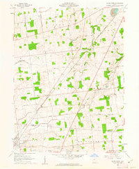
1960 Map of Silver Creek
USGS Topo · Published 1962About this map
The village of Belle Center anchors the southwest corner of this 1960 survey, situated near the Hardin Co Logan Co boundary. The landscape is a patchwork of agricultural woodlots and family-named routes such as Bingham Road and Shick Road. The New York Central railroad cuts diagonally through the terrain, passing through the settlement of Yelverton and providing a transportation spine for the rural economy.
Find a feature on this map
39 named features on this map. Tap any name to fly to it.
Don’t see what you’re looking for? This feature index may not catch every label — zoom into the map to look around manually.
Map Details
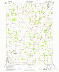
Editions of this 1960 Silver Creek Map
2 editions found
Other maps of this area

1913 · Alger
USGS Topo · 1:48,000

1913 · Bellefontaine
USGS Topo · 1:48,000

1913 · East Liberty
USGS Topo · 1:62,500

1915 · Alger
USGS Topo · 1:62,500

1915 · Bellefontaine
USGS Topo · 1:62,500

1915 · East Liberty
USGS Topo · 1:62,500

1915 · Kenton
USGS Topo · 1:62,500

1943 · Alger
USGS Topo · 1:62,500

1944 · East Liberty
USGS Topo · 1:62,500

1944 · Kenton
USGS Topo · 1:62,500