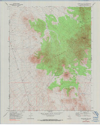
1971 Map of Silver King Mtn.
USGS Topo · Published 1990About this map
The Schell Creek Range dominates this corner of the Great Basin, where high-elevation topography meets the arid desert floor. This 1971 survey details the complex terrain surrounding Silver King Mountain and the neighboring Burnt Peak, providing a clear record of the area's geological and mineralogical interest. Evidence of past exploration is visible at a marked Prospect located on the eastern slopes, a common sight in this mineral-rich portion of the Nevada interior. The isolation of the landscape is underscored by the presence of a Burnt Peak Well (Dry) and the network of faint Jeep Trails that serve as the primary means of access. The boundary between Nye Co and Lincoln Co bisects the western half of the map, marking the administrative divide in this sparsely populated region of public lands.
Find a feature on this map
15 named features on this map. Tap any name to fly to it.
Don’t see what you’re looking for? This feature index may not catch every label — zoom into the map to look around manually.
Map Details
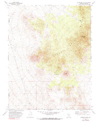
Editions of this 1971 Silver King Mtn. Map
3 editions found
Other maps of this area

1956 · Lund
USGS Topo · 1:250,000

1960 · Lund
USGS Topo · 1:250,000

1969 · Gap Mountain
USGS Topo · 1:24,000
1971 · Silver King Mtn SW
USGS Topo · 1:24,000

1971 · Bailey Wash
USGS Topo · 1:24,000
1971 · Timber Mtn Pass NE
USGS Topo · 1:24,000

1971 · Silver King Mtn
USGS Topo · 1:24,000

1971 · Sidehill Pass
USGS Topo · 1:24,000
1971 · Silver King Well
USGS Topo · 1:24,000
1971 · Timber Mtn Pass East
USGS Topo · 1:24,000