
1963 Map of Silver Star Mountain
USGS Topo · Published 1992About this map
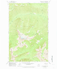
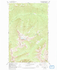
Silver Star Mtn serves as the focal point of this 1963 field-checked topographic study, where the high-altitude drainage systems of the Okanogan National Forest are meticulously detailed. The landscape is defined by its dramatic crests, including the precipitous Vasiliki Ridge and Kangaroo Ridge, which channel meltwater into complex creek networks. Notable water bodies such as Shelokum Lake, Varden Lake, and the curiously named Mudhole Lake are shown tucked between these granite divides. The map captures a transitional era for the region's wilderness management, illustrating the established Early Winters Trail and Butte Trail before the southern portion was formally designated within the Chelan-Sawtooth Wilderness. These footpaths follow natural corridors like Early Winters Creek, providing a record of the primitive access routes through the North Cascades prior to modern recreation infrastructure.
Find a feature on this map
26 named features on this map. Tap any name to fly to it.
Don’t see what you’re looking for? This feature index may not catch every label — zoom into the map to look around manually.
Map Details
Editions of this 1963 Silver Star Mountain Map
4 editions found

Other maps of this area

1899 · Methow
USGS Topo · 1:125,000

1901 · Methow
USGS Topo · 1:125,000

1902 · Stehekin
USGS Topo · 1:125,000

1904 · Stehekin
USGS Topo · 1:125,000

1920 · Slate Pass
USGS Topo · 1:125,000

1955 · Concrete
USGS Topo · 1:250,000

1958 · Concrete
USGS Topo · 1:250,000

1962 · Concrete
USGS Topo · 1:250,000

1962 · Mazama
USGS Topo · 1:62,500

1963 · Washington Pass
USGS Topo · 1:24,000