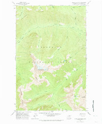
1963 Map of Silver Star Mtn.
USGS Topo · Published 1974About this map
Silver Star Mtn serves as the focal point of this high-altitude landscape within the Okanogan National Forest, where steep ridgelines and glacial cirques define the topography. The 1963 survey captures a wilderness characterized by dramatic vertical relief, from the heights of North Gardner Mtn down to the drainage basins of Early Winters Creek. Transportation is limited to narrow paths such as the Early Winters Trail and the Driveway Butte Trail, reflecting the area's role as a remote backcountry resource. The drainage network is complex, featuring the West Fork Cedar Creek and South Fork Cedar Creek which carve through the prominent rock formations of Vasiliki Ridge and Delancy Ridge. Scattered alpine waters like Varden Lake and Shelokum Lake are tucked into the high basins, providing a record of the natural hydrology before modern recreational development intensified in the North Cascades.
Find a feature on this map
25 named features on this map. Tap any name to fly to it.
Don’t see what you’re looking for? This feature index may not catch every label — zoom into the map to look around manually.
Map Details
Editions of this 1963 Silver Star Mtn. Map
4 editions found


Other maps of this area

1899 · Methow
USGS Topo · 1:125,000

1901 · Methow
USGS Topo · 1:125,000

1902 · Stehekin
USGS Topo · 1:125,000

1904 · Stehekin
USGS Topo · 1:125,000

1920 · Slate Pass
USGS Topo · 1:125,000

1955 · Concrete
USGS Topo · 1:250,000

1958 · Concrete
USGS Topo · 1:250,000

1962 · Concrete
USGS Topo · 1:250,000

1962 · Mazama
USGS Topo · 1:62,500

1963 · Washington Pass
USGS Topo · 1:24,000