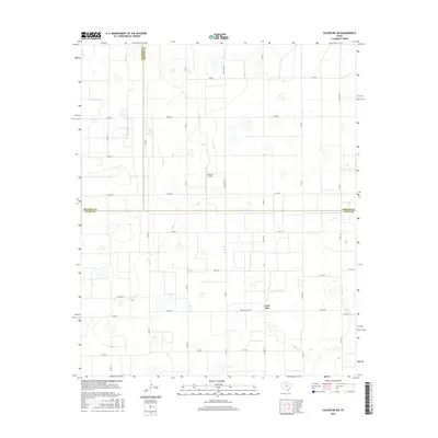
2016 Map of Silverton SW
USGS Topo · Published 2016About this map
Lone Star anchors this agricultural landscape at the southern end of the Texas Panhandle, situated near the intersection of several farm-to-market and ranch roads. The terrain is defined by a dense grid of rural corridors like Ranch Rd 378 and Fm 788 that partition the High Plains into large industrial farming tracts. A notable break in this geometry occurs along the southern boundary where the headwaters of Quitaque Cr begin to carve into the tableland. This 2016 survey captures the area's specialized aviation infrastructure at the Sherman Airport, reflecting the region's reliance on aerial application for large-scale agriculture. The map also delineates the precise meeting point of three counties, marking the boundaries between Swisher, Briscoe, and Floyd counties, which dictates local land ownership and tax jurisdictions in this sparsely populated region.
Find a feature on this map
36 named features on this map. Tap any name to fly to it.
Don’t see what you’re looking for? This feature index may not catch every label — zoom into the map to look around manually.
Map Details
Editions of this 2016 Silverton SW Map
This is the sole edition of this map. No revisions or reprints were ever made.
Other maps of this area

1954 · Plainview
USGS Topo · 1:250,000

1958 · Plainview
USGS Topo · 1:250,000

1965 · Whiteley
USGS Topo · 1:24,000

1965 · Silverton
USGS Topo · 1:24,000

1965 · Rock Creek
USGS Topo · 1:24,000

1965 · Silverton SW
USGS Topo · 1:24,000

1966 · Sterley
USGS Topo · 1:24,000

1966 · South Plains
USGS Topo · 1:24,000

1968 · Aiken
USGS Topo · 1:24,000

1969 · Claytonville
USGS Topo · 1:24,000