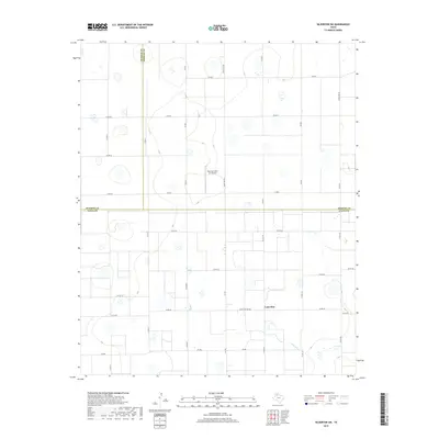
2019 Map of Silverton SW
USGS Topo · Published 2019About this map
Lone Star sits at the intersection of farm-to-market roads in the southeastern portion of this High Plains landscape. The map reveals a strictly gridded agricultural environment where the boundaries of Swisher, Briscoe, and Floyd counties converge. This intersection of three Texas counties creates a unique jurisdictional point just north of the Quitaque Cr headwaters. The terrain is defined by numerous small depressions and basins common to the Llano Estacado, interspersed with a dense network of county roads. Industrial and private infrastructure is limited but distinct, most notably the Sherman Farm Air Airport located in the central portion of the survey. This facility, along with the various ranch and farm roads like Ranch Rd 378 Spr and Fm 788, highlights the importance of aerial and ground connectivity for large-scale ranching operations during this late 2010s period.
Find a feature on this map
36 named features on this map. Tap any name to fly to it.
Don’t see what you’re looking for? This feature index may not catch every label — zoom into the map to look around manually.
Map Details
Editions of this 2019 Silverton SW Map
This is the sole edition of this map. No revisions or reprints were ever made.
Other maps of this area

1954 · Plainview
USGS Topo · 1:250,000

1958 · Plainview
USGS Topo · 1:250,000

1965 · Whiteley
USGS Topo · 1:24,000

1965 · Silverton
USGS Topo · 1:24,000

1965 · Rock Creek
USGS Topo · 1:24,000

1965 · Silverton SW
USGS Topo · 1:24,000

1966 · Sterley
USGS Topo · 1:24,000

1966 · South Plains
USGS Topo · 1:24,000

1968 · Aiken
USGS Topo · 1:24,000

1969 · Claytonville
USGS Topo · 1:24,000