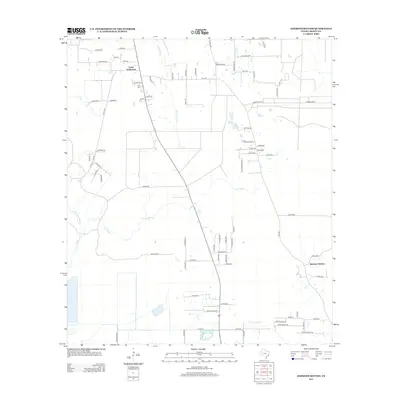
2013 Map of Simmons Bottom
USGS Topo · Published 2013About this map
Simmons Bottom and the Carter Settlement characterize the rural landscape of Liberty County in the early 21st century. This area is defined by a complex network of slow-moving waterways, including Luce Bayou and Tarkington Bayou, which drain the low-lying terrain. The map reveals a transition between established agricultural settlements and newer residential developments, visible in the winding street layouts of Timberline Blvd and Lake Wood Dr.
Find a feature on this map
80 named features on this map. Tap any name to fly to it.
Don’t see what you’re looking for? This feature index may not catch every label — zoom into the map to look around manually.
Map Details
Editions of this 2013 Simmons Bottom Map
This is the sole edition of this map. No revisions or reprints were ever made.
Other maps of this area

1916 · Huffman
USGS Topo · 1:24,000

1920 · Huffman
USGS Topo · 1:31,680

1943 · Liberty
USGS Topo · 1:125,000

1954 · Beaumont
USGS Topo · 1:250,000

1955 · Rayburn
USGS Topo · 1:62,500

1955 · Liberty
USGS Topo · 1:62,500

1957 · Beaumont
USGS Topo · 1:250,000

1958 · Cleveland
USGS Topo · 1:24,000

1959 · Plum Grove
USGS Topo · 1:24,000
1960 · Huffman
USGS Topo · 1:24,000