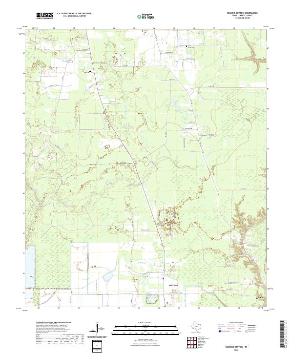
2022 Map of Simmons Bottom
USGS Topo · Published 2022About this map
The lowlands of Liberty County are defined by a complex network of waterways, where Luce Bayou and Tarkington Bayou wind through the landscape. This 2022 survey captures the modern rural-suburban interface of Dayton and the settlement of Kenefick. The northern portion of the quadrangle is largely defined by open land and family heritage sites, most notably the Gillen Family Cem near Hightower Rd and the Ryan Cem further west.
Find a feature on this map
62 named features on this map. Tap any name to fly to it.
Don’t see what you’re looking for? This feature index may not catch every label — zoom into the map to look around manually.
Map Details
Editions of this 2022 Simmons Bottom Map
This is the sole edition of this map. No revisions or reprints were ever made.
Other maps of this area

1916 · Huffman
USGS Topo · 1:24,000

1920 · Huffman
USGS Topo · 1:31,680

1943 · Liberty
USGS Topo · 1:125,000

1954 · Beaumont
USGS Topo · 1:250,000

1955 · Rayburn
USGS Topo · 1:62,500

1955 · Liberty
USGS Topo · 1:62,500

1957 · Beaumont
USGS Topo · 1:250,000

1958 · Cleveland
USGS Topo · 1:24,000

1959 · Plum Grove
USGS Topo · 1:24,000
1960 · Huffman
USGS Topo · 1:24,000