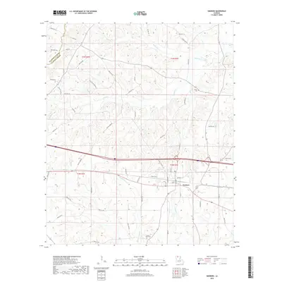
2018 Map of Simsboro
USGS Topo · Published 2018About this map
Simsboro serves as the primary hub of this north Louisiana landscape, situated at the intersection of a established road and rail corridor. The town's grid is clearly defined by landmarks such as Houston St, Rose St, and 2nd St, reflecting its role as a local center for commerce and residence. Outside the town limits, the terrain is defined by a dense network of waterways, including the Dugdemona River and its various tributaries like Walnut Cr and Madden Cr. The map reveals a history of land use through its scattered cemeteries, such as Antioch Cem to the northeast and Calcote - Powell Cem to the south. This 2018 survey captures the region's enduring mix of rural parish roads and the expanding infrastructure of Lincoln Parish, where family names persist on roads like Ross Perritt Rd and Allen Rd.
Find a feature on this map
65 named features on this map. Tap any name to fly to it.
Don’t see what you’re looking for? This feature index may not catch every label — zoom into the map to look around manually.
Map Details
Editions of this 2018 Simsboro Map
This is the sole edition of this map. No revisions or reprints were ever made.
Other maps of this area

1947 · Bienville
USGS Topo · 1:62,500

1949 · Bienville
USGS Topo · 1:62,500

1950 · Ruston
USGS Topo · 1:62,500

1950 · Arcadia
USGS Topo · 1:62,500

1951 · Arcadia
USGS Topo · 1:62,500

1951 · Ruston
USGS Topo · 1:62,500

1953 · Hodge
USGS Topo · 1:62,500

1955 · Shreveport
USGS Topo · 1:250,000

1956 · Shreveport
USGS Topo · 1:250,000

1984 · Shreveport
USGS Topo · 1:250,000