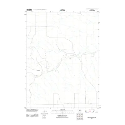
2011 Map of Singleton Ranch
USGS Topo · Published 2011About this map
Lawrence Fork meanders through the arid tablelands of Cheyenne County, defining the primary drainage pattern of this high plains landscape. At the heart of this ranching country is the Singleton Ranch, situated near the southern banks of the fork. The presence of Singleton Dam Number 1 indicates the vital importance of water management for agriculture and livestock in this environment, where seasonal runoff is captured within the deeper recesses of Rocky Hollow. A network of section-line roads, including Co Rd 18 and Co Rd 54, crisscrosses the terrain, tracing the rectilinear pattern of land division that has shaped western Nebraska since the homesteading era. This survey provides a clear view of how large-scale ranching operations utilize natural landforms and water systems to maintain productivity in a region characterized by wide-open spaces and sparse settlement.
Find a feature on this map
15 named features on this map. Tap any name to fly to it.
Don’t see what you’re looking for? This feature index may not catch every label — zoom into the map to look around manually.
Map Details
Editions of this 2011 Singleton Ranch Map
This is the sole edition of this map. No revisions or reprints were ever made.
Other maps of this area

1898 · Scotts Bluff
USGS Topo · 1:125,000

1898 · Camp Clarke
USGS Topo · 1:125,000

1954 · Scottsbluff
USGS Topo · 1:250,000

1958 · Scottsbluff
USGS Topo · 1:250,000

1973 · Potter 2 SW
USGS Topo · 1:24,000

1973 · Scotts Bluff 4 SE
USGS Topo · 1:24,000

1973 · Kimball 1 SE
USGS Topo · 1:24,000

1973 · Kimball 1 NE
USGS Topo · 1:24,000

1973 · Potter 2 SE
USGS Topo · 1:24,000

1973 · Potter 2 NW
USGS Topo · 1:24,000