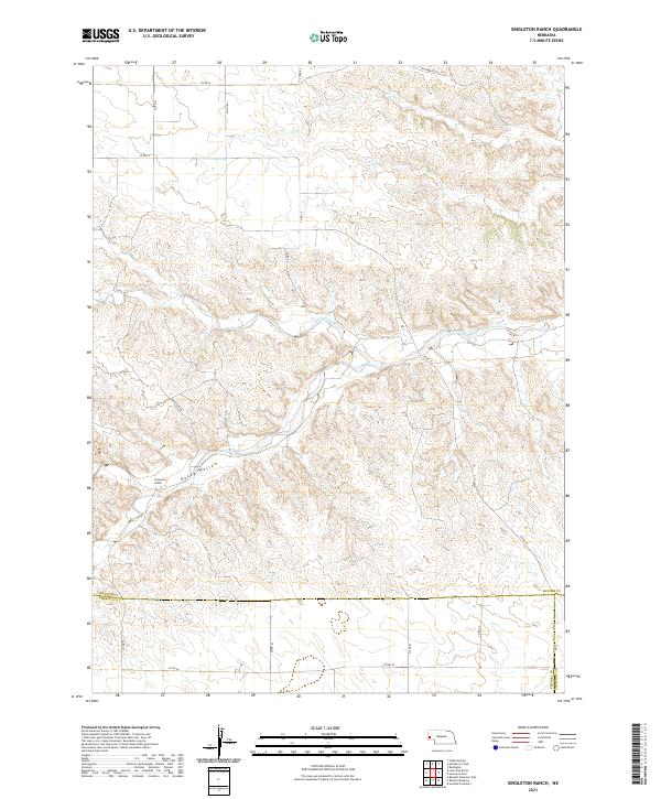
2021 Map of Singleton Ranch
USGS Topo · Published 2021About this map
Singleton Ranch sits at the heart of this high plains landscape, where the drainage of Lawrence Fork cuts through the Nebraska panhandle. The topography is defined by the incision of Rocky Hollow and various unnamed coulees into the surrounding tableland. Human presence is marked by a rigorous section-line road grid, including Co Rd 16, Co Rd 63, and Co Rd 14, which facilitate travel through this ranching country. The map clearly delineates the administrative boundary between Banner Co and Kimball Co to the south. This modern survey shows how land management and transportation remain closely tied to the natural hydrology and drainage patterns established by the fork, even as remote ranching operations like the Singleton Rd access point continue to anchor the local geography.
Find a feature on this map
24 named features on this map. Tap any name to fly to it.
Don’t see what you’re looking for? This feature index may not catch every label — zoom into the map to look around manually.
Map Details
Editions of this 2021 Singleton Ranch Map
This is the sole edition of this map. No revisions or reprints were ever made.
Other maps of this area

1898 · Scotts Bluff
USGS Topo · 1:125,000

1898 · Camp Clarke
USGS Topo · 1:125,000

1954 · Scottsbluff
USGS Topo · 1:250,000

1958 · Scottsbluff
USGS Topo · 1:250,000

1973 · Potter 2 SW
USGS Topo · 1:24,000

1973 · Scotts Bluff 4 SE
USGS Topo · 1:24,000

1973 · Kimball 1 SE
USGS Topo · 1:24,000

1973 · Kimball 1 NE
USGS Topo · 1:24,000

1973 · Potter 2 SE
USGS Topo · 1:24,000

1973 · Potter 2 NW
USGS Topo · 1:24,000