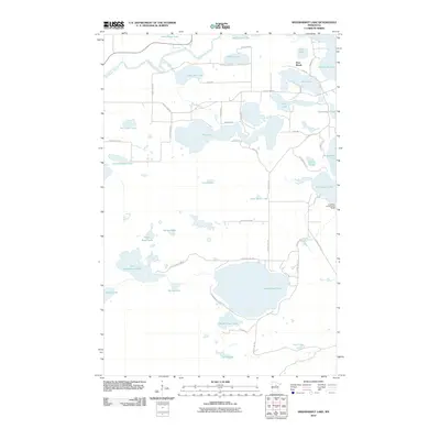
2010 Map of Siseebakwet Lake
USGS Topo · Published 2010About this map
The Mississippi River winds through the northwestern corner of this Itasca County landscape, establishing a riparian corridor that gives way to a dense network of glacial lakes and wetlands. Dominated by Siseebakwet Lake and the western reaches of Pokegama Lake, the area shows a transition from the agricultural and riverine activity near Bass Brook to a specialized recreational geography.
Find a feature on this map
54 named features on this map. Tap any name to fly to it.
Don’t see what you’re looking for? This feature index may not catch every label — zoom into the map to look around manually.
Map Details
Editions of this 2010 Siseebakwet Lake Map
This is the sole edition of this map. No revisions or reprints were ever made.
Other maps of this area

1953 · Cohasset East
USGS Topo · 1:24,000

1953 · Siseebakwet Lake
USGS Topo · 1:24,000

1953 · Cohasset West
USGS Topo · 1:24,000

1953 · Grand Rapids
USGS Topo · 1:24,000

1954 · Hibbing
USGS Topo · 1:250,000

1957 · Hibbing
USGS Topo · 1:250,000

1958 · Hibbing
USGS Topo · 1:250,000

1964 · Hibbing
USGS Topo · 1:250,000

1970 · Big Thunder Peak
USGS Topo · 1:24,000
1970 · Mountain Ash Lake
USGS Topo · 1:24,000